 |
Pico Do Arieiro - the highest mountain of the island

While in the north west of the island the elevated plain Paúl da Serra extends, further into the east, there are the central mountains of the island that are nearly 2.000 metres high.
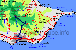
In north/south direction, there is a mountain range with three peaks and each is more than 1.800 metres high: in the north, there is the Pico Ruivo (red hair pike), that with a height of 1861 metres is the highest mountain of the island. Further into the south there is the Pico das Torres (top of the towers), that with its height of 1851 m, it nearly approximates the Pico Ruivo and therewith it is the second highest mountain of the island. Further into the south, there is the Pico do Arieiro that is, with a height of 1818 m, the third highest mountain of the island.
Even if the Pico do Arieiro is "only" the third highest mountain of the island, it is the most visited peak of the island. The reason for this is on one side that it is very easy to get fast to the mountain from the area of Funchal, and on the other side there is a very well arranged road that leads up to the top of the mountain. First, this trip belongs to each Madeira visit; countless tourist busses clamber every day the third highest mountain of the island.
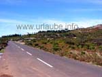
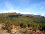
The trip to the Pico de Arieiro from Funchal is already a big pleasure. To the highest point of the Poiso pass that is of approximately 1400 metres, one drives through a dense coniferous forest that is specially beautiful when the sun slightly gleams. Sometimes, the Needles cover a major part of the road, so that one feels like driving through a forestry road through the forest. Slowly, one gains altitude and get more and more curious what would be visible if the forest was not there. Finally, at a height of 1500 metres, the forest thins out and is replaced by bald areas. Bracken, blueberries and different sorts of grass emboss from now on the picture. The mountain area appears to be dry and abandoned, but it is so fascinating that one repeatedely stops in order to enjoy the view, either downwards as also upwards.
Finally, one achieves the mountain top of the Pico do Arieiro and first, one is shocked by the hype that is going on there; A huge parking place transmits the feeling that one is standing in front of a shopping centre somewhere in the city. Indeed, this parking place is always crowded, but there is a continual coming and going, as most of the visitors do not stay for a long time. Underneath the mountain top there is a mountain ressort (Pousada) with all conveniences for the tourists: restaurant, souvenir shop, little sales booths, toilets, etc.
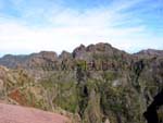
The "ascent" of the Pico de Arieiro, if this word is appliable at all, is done in a few minutes from the restaurant. For this, neither alpine boots nor other kind of equipment is needed. After a few stages up to the mountain top, one has panoramic vision that cannot be soon forgotten: first, the view goes to northern direction, where there is the second highest mountain top of the island, the Pico das Torres, in front of the Pico de Ruivo. Thus, the highest mountain of the island is not visible from the Pico do Arieiro. By viewing the Pico das Torres one also notices where the name of the mountain comes from: the mountain peaks appear like towers, this is the reason why the name is tower mountain (Pico das Torres).
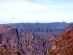
Immediately after the view to the highest mountain tops of the island, of course a view into the depth has to follow: in southern and eastern direction, it is possible to look down up to the coast. And then, of course, the view to the west: the elevated plain Paúl da Serra appears to be a mightful board, as if somebody just pressed the mountain top. Also the Windmills that one probably already passed during the visit to the elevated plain are visible. It is hard to believe that this elevated plain is separated form the high mountain tops on which one stands, by a deep canyon.
One of course experiences an absolute highlight by starting the trip to the Pico do Arieiro in the early morning. One does not only experience the breathtaking sunrise, but also the cliff flanks glisten in beautiful pastels. Little groups of clowds that at night were in the valley slowly ascent to the sky and one really feels how the cliffs slowly get filled up with sun energy .
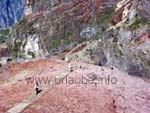
This is the standard program, that is an absolute obligation of each of the visitors of the island. But after the drive-up to the mountain top and the enjoyment of the fascinating panorama vision the snowstrom realy hits, as from Pico do Arieiro one of the most spectacular hiking tours start that one can imagine: on a path on the mountain top, one first walks to the Pico das Torres, then to the Pico Ruivo and finally to the Achada do Teixeira in the north of the island and/or one returns to the Pico do Arieiro after having climbed the highest mountain.
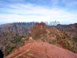
The first part of this tour is still made by many tourists wearing sandals, the approximately 20 minutes walk up to the first big view point is done on well arranged roads with secured paths. But the view point is not that easy, as from there it goes steeply down to the valley. The view is breathtaking, but at this point one should be free from giddiness .
What comes afterwards is a hiking of 2,5 hours with all knobs on and highlights. Many stairs go up and down and the path goes through the mountain in tunnels with a length up to 100 metres; those who have no electric torch will surely not get lost but will surely step into some of the deep puddles og the tunnel. After strong rainfalls, there are oftenly landslips and the path is barred; then there are some loop ways and/or completely new ways up to the mountain top. There are repeatedely view points with views that will be unforgettable for a lifetime. Thus, it is quite difficult to state an exact time schedule for this hiking tour, as one probably spends a lot of time having breaks at the view points.

Back to the index Madeira
Copyright: Patrick Wagner, www.tourist-guide.biz
|
 |