|
|
|
Day Tour in the South of the Island Mauritius
The tour at the south of the island through the big national park of the black river is apparently the most famous tour of Mauritius. Here, not only numerous buses full of tourists but also countless taxis drive through. Considered in kilometres, the tour is not long and it could be done by car within an hour, but it takes unbelievably much time if one really enjoys the numerous and good views of the drive through the overgrown rain forest. 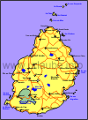
We start our tour by visiting a tea factory, view some tea tea plantations and try the tea which production we have just been watching at. Then we make a short visit to the Hindoo centre of the island, where we view several temples, a big lake and a very high Hindoo god statue. After that, we drive unhirriedly through the biggest National Park of the island and are impressed by the variety of plants, the wonders of nature and by the excellent views. We finally drive further to Chamarel, where we view the biggest waterfall and a piece of coloured earth. Our tour ends then in Morne Brabant, where we gaze at a massive rock colossus on a peninsula and probably afford to spend an hour on the beach.
Tea Factory Bois ChériBois Chéri is is an inconspicuous small place on the map in which we do find something that until then we only knew being finely ground: tea. Aleady during the trip to Bois Chéri we drive through numerous tea plantations and are stunned about the way this good drink grows in the nature: the approximately 1 metre high bushes carry some leaves on their top from which the good tea is made. These leaves can be picked every 15 days; We continuously see complete crews of tea leaf pickers going through the plantations. But we also see some bald cut tea bushes that after numerous haversts need a new attempt and are therefore cut back. Until such a tea plant gives some good leaves for the first time, believe it or not, it takes 5 years after the first planting. For an average European these are very interesting aspects, because die fewest ever saw tea growing in the free nature. 
What happens now with the picked leaves, are they simply chopped and packed into tea bags? In order to clarify this question, we visit the tea factory in Bois Chéri. For an acceptable entrance fee we get a guidance through the factory; Right at the machines, it is explained to us in English language what happens with the tea leaves. We learn the meaning of fermentation and we see how the leaf pieces are dried and we also have a look to the filter systems that sort the tea into different grain sizes. Finally we also watch how the tea is flavoured and, of course, we also watch how the tea is finally put into little bags. It is simply interesting to look over the personnel's shoulders and to see the things one might already have been wondering about how they are done when drinking a good cup of tea. 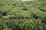
The visit to the factory takes barely half an hour, then we have a short view into the adjacent small museum, and then we drive a piece up the hill where we see again some tea plantions and on a hill we find a small building where we are finally also allowed to drink some tea. The teatasting is included in the entrance fee of the factory. We get some hot water and 8 different kinds of tea to try. Additionally, some cookies are served so that the thing is not too liquid. We enjoy our good tea and the very nice views from the hill and finally buy some few packages of mauritian tea as a souvenir. The factory viewing, the visit to the museum and the teatasting took approximately 1,5 hours, but I can really recommend this side-trip to everybody, because one learns something and sees something that until then was unknown and one gets some good tea with some cookies. Grand Bassin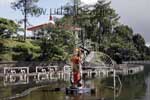
By driving from the tea plantations in western direction we pass a small lake at which we pleasantly have a stop, as a monument heighted more than 10 m made us curious. The small lake is called Grand Bassin and it fills a former volcanic crater. The big monument that we already saw from a distance represented the Hindoo god Anoimanga. At the lake shore, we see some small Hindoo-temples with some colourful small statues in their interior. As it is the case in all Hindoo-temples, here it also applies that the inner patio can be only accessed with bare feet. What is special at this place? While normaly, one finds here a calmed spot of nature, there are in February or March thousand of Hindoos here meeting for some ritual devotions. It is the so called Maha-Sbhivaratree-festivity that is celebrated once a year at the lake. For us, the grand Bassin is only a short stop as it is anyway on our way and we continue driving in western direction. Black River Gorges National ParkAfter only a few kilometres by car we arrive at Le Pétrin, the beginning of the great Black River Gorges National Park. In Le Pétrin we find a small station from which many hiking tours can be started. Here, also some rangers reside who are pleased to give one some information and suggest some routes based on the maps. Some photoposters show the visitors what is expecting them at this National Park. There are also some toilets here and this is the reason why many excursionists and tourist buses have another small stop here before starting the tour to the National Park. 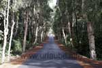
The National Park's name comes from the canyon of the black river (Black River Gorges), to which we will gaze at later on. The biggest National Park of its kind of Mauritius is, at its deepest area still approximately 300 m over the sea level; but the mountain peaks rise up for more than 800 m; the highest point is the mountain Black River Peak with a height of 828 m. The big National Park extends on a total of 66 km²; for a small island as Mauritius, this is a considerable size. The main attraction are the highlands Plaine Champagne on approximately 750 m, through which we slowly drive. What do we see as visitors of the Black River Gorges National Park? First of all, it is to be said in advance that in some parts of the National Park, there are more than 4000 mm rainfalls per year. In conjunction with the strong day sun, these are perfect tropical conditions for a bright growing of vegetation, and this is exactly what we admire during our first kilometres through the park. In the Black River Gorges National Park, hundreds of tropical green plants grow; At the left and at the right side of the road dense bushes and trees sprawl out. When we occasionlly stopped in order to look closely at the unbelievable upgrowth, we immediately recognize that if we were walking, we would not get 10 m forward in this brush as here, the earth is overgrown so densely. The road is indeed kept free from the growth of the vegetation, but apart from that all interventions of human kind are forbidden in this natural reservoir. Moreover, in this National Park active natural protection is practised (umpteem years ago, this word was not known yet in Mauritius); birds in danger of extinction got a new home here, and the success is satisfactory. 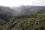
During the first kilometres we were only impressed by the rain forest at the left and right side of the road, we also did not see anything else except the blue sky. But then the first highlight came out; we turned to the left into a road and drove to the Alexandria-waterfalls. Also on the way to this side trip we had several stops as we saw something from which we only heard until then: we drive through a forest full of papyrus-trees. Fascinated, we pick up some papyrus-shreds from the ground that were spread under the trees. It is unbelievable, in fact we held a kind of paper in our hands. Thus, 2000 years ago some biblical stories were written on such material. It is a nice feeling to hold personally such a piece of natural material fresh from the tree. After driving one kilometre, the first mobile merchants are waiting for us on a parking place, providing us drinks, snacks and some souvenirs. From the parking place we walk for 5 minutes until we arrive at a small observation deck. From there, we see the Alexandria-waterfalls falling down into the valley. But much more that the waterfalls, the view to the dense rain forest fascinates me; from here, the competition among the different kinds of trees to get the most sun light gets really visible. From this view point we also have a wide view down to the south coast of the island. By means of the white crests we guess how strong the surge breaks against the south coast. 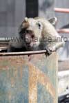
We continue driving for only a few minutes until we already see the next big parking place and we guess that the next highlight is coming. We park our car and simply walk alongside a small concrete path with numerous merchants up to an observation deck, where first our breath is taken away. We look downwards to a deep valley into which the waterfall of the black river falls. Somewhere down there, the Grande Rivière Noire also continues flowing in direction to the west coast of the island, but in the brush of the primeval forest we can only guess where the riverbed of the black river is located. It is really impressive to look down from here to the rain forest abundantly covered with vegetation. And while we stare for some minutes into the depth, two monkeys suddenly jump out from the trees and another one climbs out of a dustbin Mülltonne. The first one gets straight away his lunch served by some visitors, the second jumps at a straying wild cat and the third already returns into his dustbin in order to sleep; what a monkey see monkey do! We enjoy again the marvelous view down to the valley of the black river and continue then our drive through the National Park. We probably drive with an average speed of 30-40 km/h on the narrow small roads that are bordered by some high bushes and repeatedely have some stops in order to be impressed by the plant brushes. We repeatedely find some mature guavas that can be picked and eaten right from the tree. When it goes down again from the highlands into the valley, we notice that we arrived at the end of the Black River Gorges National Park. The next highlight is waiting for us! Chamarel Waterfall and Coloured EarthAfter we left the highs of the National Park, we arrive as next at the bigger place Chamarel. At first, we are pleased to find some small restaurants in file, as after the leisurely drive through the highlands we feel a little hungry but specially very thirsty. The place Chamarel itself is nothing special; but it is famous for its good cofee. And in fact, here, I see for the first time in my life a coffee plantation. I wonder how many centner coffee beans my body got during my life until now, before my eye sees for the first time a coffee plantation in reality. 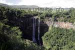
But we did not drive to Chamarel to see some coffee plantations but to gaze at a huge waterfall. There is a small entrance fee to pay at a barrier, then we drive on a bumpy and narrow road down to a small parking place, from which it takes a walk of a few minutes to the observation deck. From here, we have a fantastic view to the Chamarel-waterfall; the river upside seems to appear from nowhere. But we are not only fascinated by the waterfall itself but also the view back to the groves of the National Park located behind it. Of course, at this spot, a wild fotoshooting takes place. 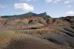
We continue driving a further piece up to the Terres des Couleurs, the coloured earth. Here, we in fact see a hectare of coloured earth that, depending on the sun radiation and the location, it shines in different colours as yellow, orange, ocher, redish and even bluish. There is no scientific explanation for such a phenomenon, but apparently some oxidation processes have played a role. As a visitor, one should not expect anything extremely fabulous; those who have already seen the volcano landscape of Lanzarote (see National Park Timanfaya), will be rather disappointed by this mini view of the coloured earth. Here, a tiny natural phenomenon was greatly arranged for tourists. Originally, the area was even and in order to make it more attractive, some artificial ground waves were placed. Le Morne BrabantDuring the continuation of our trip in western direction we aleady see a distinctive mountain on the southwest tip of the island, the Morne Brabant. The 556 m heighted mountain rises from the sea as an emblem. It is a place full of history: during the French occupation period, many slaves escaped to this mountain peak in order to escape from the slavery. When then three English people took over the island and abolished the slavery, they sent the police up to this mountain in order to inform the slaves there of their luckiness. But they thought they were caught and jumped down the rock. 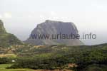
We enjoy the view to this great rock for which the small peninsula at the south west seems to be specially made. Than we increasingly approach the mountain and drive down to the beaches. There are several gorgeos beaches in this area, why some big hotels are settled here. The whole island tip is surrounded by coral reefs, so that snorkeling people find here a paradise for watching the fishes. Until now, our tour was short in kilometres, but it nearly took a whole day, as we did not want to enjoy the National Park just by passing it during our drive, but repeatedely did some stops in order to make some pictures and in order to have a close look to the trees and the bushes. 
Copyright: Patrick Wagner, www.tourist-guide.biz |
||
 I want to give each reader of this page an important tip before starting to read: one drives through a piece of natural tropical rain forest; as known, here are numerous mosquitos. Even if it is a little hot at a height of 700 m in the radiating course, I seriously recommend to wear some comfortable and long trousers in order to be protected against the mosquitos. Those who look at a local bus or taxi driver will notice that they all do wear long-sleeved shirts and long trousers. Myself, I did the tour with a t-shirt and shorts but I wisely generously applied some insect spray. It did not provide any result; Each half an hour I discovered some new itching spots on my legs; the generous application of more spray did not help.