Transalp stage 1 - Start in Miesbach
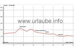
Miesbach - Spitzing - Kramsach - Fügen: (73 km, 1130 altitude metres)

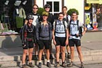
On the first day, we meet at 09.00 a.m. at the market place in the centre of Miesbach.
After saying hello, a short revision of the luggage and the redistribution of the replacing material and tools we
start in southern direction. Passing Hausham, the Schlier lake and Neuhaus, we get to our first ascend - 364 altitude metres up over the old Spitzingstreet to the Spitzingsattel mountain.

The temperature is pleasant with 20 degrees and after the ascend, we comfortably circle the Spitzing Lake with its clear blue-green water. At the end of the lake, we turn into the blocked toll road in direction to Valepp and roll without any effort down up to the forester's lodge. After 6,5 km, we turn to the right in direction to the Erzherzog-Johann-Klause and Kaiserklamm.
Erz-Herzog-Johann-Klause and Kaiserklamm
The Erz-Herzog-Johann Klause that today is so popular among hikers and mountain bikers, was built between 1833 and 1835. A Klause is a kind of reservoir in which water and wood is collected in a collectingg basin before the Trift begins. Within two hours, it is possible to hike all over the Bavarian part of the Erz-Herzog-Johann-Klause that needed some repairs frequently. The retaining wall had to be repaired eight times in total. The strain caused by the continuously jerking woods and the massive water pressure was huge. Not earlier than in the middle of the last century, the defile got a retaining wall of reinforced concrete. Today, there are some intensive efforts to restore this cultural heritage and to provide the defile with a roof again. The reservoir was a technical marvel of that time. This is the reason why it is exposed in the technical museum of Vienna as a model for the historical wood harvesting.
Meanwhile, it is noon time and we decide to get refreshed in the Kaiserhaus. We replaced the lost calories with some pasta and salad and after a break of barely one hour, we continue cycling downhill in direction to the Brandenberger Ache and the wonderful landscape of the Kaiserklamm.

Once, the Kaiserklamm was one of the most dangerous and hard working places of the whole area. It was the biggest wood drift of the centre of Europe. Today, it is a place of leisure and adventure, a dream place of recovery and a placa full of culture as it is noticeable during a hiking tour alongside the river. The Brandenberger Ache is a wild and small river that falls down the rock canyons foaming in white that afterwards slowly flows unhurriedly and shining in emerald green. It is hard to believe that this partly thundering whitewater was suupposed to be apt for the wood transportation, thus for the so-caled drift. But its origin goes back up to the year 1412. At that time, this area was still Bavarian, thus it did not belong to Tyrol. Thus, the first permission for the building of a so-called rake was of course given by a Bavarian duke. With this rake, the drifted wood could be rrecollected. This was the beginning of the timber industry of the Ache.
When then, in the middle og the 15th century the silver- and the copper mining increased in this area, some hufge amounts of firewood were needed for the smelting works in the valley. This led to a destructive exploitation off the forests and the sovereigns took the timber industry under their control. The work as a wood-cutter, the brook-, drift- and defile - masters was very hard and dangerous. The wood-cutters hewed the trees with a so-called heel. Thiwss was a flat axe that was rounded at the blade and had a long shaft. Later on, the Wiegensäge was used. The drift master has a specially nerve-wracking job. When the trunks with a length of approximately 2 m wedged together during the drift through the defile, they had to untangle this chaos. Therefore, they went down the canyon hanging on ropes. With some poles, the trees could be loosen. During this breakneck work, there were repeately deaths.

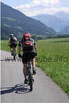
In Pinegg, a small but heavy opposing climb of only 100 altitude metres is waiting for us, but, after having had lunch, resulted to be very tough. From here, the way only goes downwards though the wild and wonderful landscape of Kaiserklamm in direction to the Inntal and Zillertal. After a racy descent on unpaved and paved pistes, we do not stop untilarriving at Kramsach in the Inntal.
Inntal and Zillertal
Kramsach is located at the lower Inntal of Tyrol at the northern shore of the Inn and extents on the alluvial cone of the Ache of Brandenberg in front of Rattenberg. For several centuties, Kramsach was the destination of the wood drift of tree trunks for the mined ore in Brixlegg. From the glassworks that operated there, only the technical glass school remains. We cross this place and keep on cycling up the Inn in direction to Jenbach and Zillertal. We have still approximately 20 km to cycle on pa palin ground until we arrive at Fügen, our first station where we will stay over nicht. We fastly cycle with sunny weather alongside the Ziller and enjoy the view to the surrounding mountains.

From the Inntal, the Zillertal branches off at approximately 40 km at the east of Innsbruck, close to Jenbach. The valley separates the Tux Alps at the west from the Alps of Kitzbühel at the east. In the south, at the border of South Tyrol, there are the Alps of Zillertal with the main range of Zillertal. Politically, it belongs to the district Schwaz.In contrast to the other side valleys of Tyrol, the Zillertal remains essentially at the same elevation, ascending barely perceptibly from the valley bottom in Strass (elev. 522 m) to Mayrhofen (628 m). Between Aschau and Zell at the Ziller, the valley narrows to approximately half of the width and splits into a front and a back valley. we arrive at Fügen and check in the hotel Sonne.
Fügen is considered as the main place of the front Ziller Valley. The place is located on the wide flow cone of the Rischbach. The 80 kilometres done on the first day are really noticeable in he legs and also in other parts of the body. But we do not abstain from having a coffee after a thorough shower and to look for a cozy restaurant for the eveningu suchen. Enjoying some pizza and wine, we let the day come to an end.

Back to the index Transalp
Author: Kirsten Huber; Copyright: Patrick Wagner, www.tourist-guide.biz
|