|
|
|
Gran Canaria Tour through the West+North of the Island
For those who spend a couple of days in gran Canaria and want to discover more of the island instead of only bathing, we can recommend a Tour through the island. With the rented car, one has to calculate not even a full day, depending on how much time one wants to spend in each of the stations; We start with our circumnavigation in the southwest by Puerto de Mogán. At the west of Puerto de Mogán, there is no road leading alongside the coast, so that one first has to get to the mountains over the GC-200 through the Barranco de Mogán; Passing Mogán, the GC-200 leads further alongside a lot of parallel canyons until one gets to San Nicolás de Tolentino that is located at the upper side of the centre of the island at the west. Up to here, the panorama is marked by some spectacular canyon serpentines. From San Nicolás it is not far to the coast by Puerto de Aldea. At this small place one can consider getting refreshed in the water befor e continuing the tour over some steep coastal roads further into the direction of Agaete. Here, one also has a nice opportunity in Puerto de las Nieves, and/or Playa de la Nieves for having a bath at the beach. 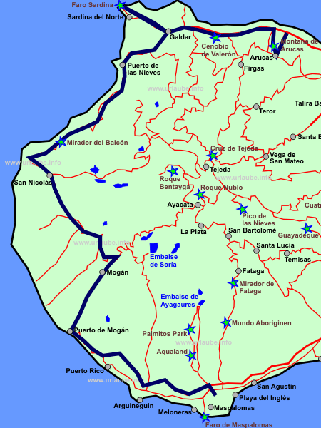
In Agaete, two roads lead further to the GC-2 that pass Gáldar as a motorway. Gáldar itself appears to be very bizarre. The lower third of the lava dome that is already visible from a distance is completely covered with colourful houses that apparently did not follow any kind of building project order. As we in any case wanted to see the north eastern tip of Gran Canaria and the sight to Tenerife attracted us, we made a side-trip to Sardina del Norte and its light house. But as this area appeared to be very passably, one should only get there in case there is really a good sight to expect. Otherwise, the side-trip is not worthwhile, as the area was simply barren. In order to continue further alongside the northern coast, we had to pass again Gáldar. As we did not plan to visit Las Palmas, we took the exit to Arucas. This very impressive city was the last station of the circumnavigation of the island from which we took, after passing two other small places, straight away the motorway GC-3. If one want to get rapidly from A to B in Gran Canaria, one should in any case take the motorway, even though a small parallel road looks very attractive on the map. The mere drive on the motorway from the north to Maspalomas in the south took a little more than half an hour. We visit the places in the east and in the south in two other tours that we describe as east-tour or tour through the canyon in the south. Puerto de Mogán or 'Small Venice of Gran Canaria'The first place of our island tour is Puerto de Mogán. Those who are on holiday in a southern holiday resort as Maspalomas or Playa del Inglés are in approximately half an hour in Puerto de Mogán, as it is possible to drive a main part of the stretch on the motorway. The street leading into the place was surrounded by building sites. The first impression was marked by a bigger hotel complex and a huge shopping centre. Not until getting to the centre of Puerto de Mogán, the charm of this small place was dismantled step by step. 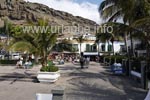
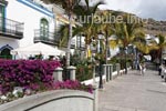
The many partly arched bridges and the water roads remind on Venice, a thing that makes the nick name "Small Venice" understandable. Here, nothing appears showy, nothing padded, as the accommodations for the tourists in the centre are almost smaller apartment complexes that do not exceed 2 floors. Due to their narrowness, the alleyways appear very lovingly with the brightly decorated small balconies with an abundance of flowers . Some smaller places alongside the promenade invite to relax with their banks and at some spots, the view goes up to unspoilt rocky landscapes. The many grass strips generate a certain cozyness to which surely the clear size of the smallplace does contribute; Also if some day excursionists lose their way to Puerto de Mogàn, the ado seems to be here slowlier. The whole tranquility of this small place makes a walk slow down to a real comfortable loafing. This walk is not comparable with the loafing at some bigger promenades in Maspalomas or Meloneras, where a hectic ado can arise due to the many people or numerous boutiques animate one to get distracted. 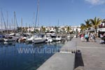
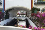
Also the port complex of Puerto de Mogàn contibutes a lot to the beautification of the atmosphere. By loafing alongside the boardwalk, one has a fantastic view to the boats floating on the water. One can get here anytime to one of the restaurants located here. No matter if one is looking for a German schnitzel or fresh fish, one will find in any case what he wants. The impressive thing of this small village is that it is an interplay of originality and that what one wants to offer to the tourists. 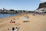
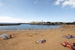
The way to the beach is not far from the port. There is a nicely arranged mole with a fine golden sand beach separated by a bridge. The water is shallow up to a wide distance and the bathing vacationers could still have enough space between each other. Also the boardwalk is nicely arranged in this area with some nice benchs with which it is possible to sit in front one of the nices cafés without having to drink or eat anything. Those who can should rent a deck chair or a parasol and get well equipped for a full day on the beach. The advantage of this area in the south-west is the relatively still air that is not possible to get at the eastern part of the island. Due to the situation at the lee of the trade wind, one has some optimal conditions for sun bathing, so that one has not to struggle with the blowing wind as it is the case for example in Maspalomas. Mogán: Administrative Centre amidst the same-named CanyonAfter loafing a little in Puerto de Mogán through the nice alleyways and alongside the port, the dirve continued into the canyon of Mogán. It is slowly getting up and the canyon gets continuously narrow. On the drive to Mogán, there is a big wind mill at the left, Molina del Viento, in the same-named place. Here, there are over-sized sculptures (e.g. a teapot) collected for which it is not very worthwhile to do a stop in between. It is fully enough to pass this place by car at a low velocity in order to be able to have a look from the car. But one surely does not miss anything by just passing it. 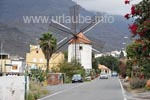
The small place Mogán itself made a very nice impression by passing it through, but anyone of us felt like having a stop in between at any spot. We did not have the impression this place wanted to invite the tourists to get into one of the few restaurants or having a small walk there; Even though Mogán is the administrative centre of the southwest, the significance of this place is is not noticeable. 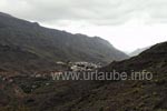
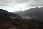
By leaving the Barranco de Mogán at the upper part of Mogán, in the further way, one comes across to various canyons. Almost the whole of the area at the west is under natural protection since many years. The leafy precipies are really an impressive diversification to the flat, scarce east of Gram Canaria that is misstreated by the wind. The panorama is really spectacular, the drive respectively adventurous. 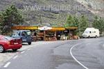
If one does not currently have to take care of the cyclists, at some spots there is to care not to get impatient by driving through the serpentine roads. There are repeatedely some fantastic view points. Either one drives into a small parking opportunity at the edge of the road or one waits until a bigger parking place is reached form which most of the times, some hiking paths branch off. Still before the Mirador de Tasartico that is mentioned in the map from which one has a superb free view to the north-west coast, with the Fuente de los Azulejos we came across to a very colourful view point where one could buy some fruits and all kinds of souvenirs. Here, some merchants have set a stationed but still mobile quarter; one is so surprised that one obligatorily first stops in order to have a look, even though one is neither hungry nor interested in souvenirs. San Nicolás and the Playa de la AldeaDuring the further drive alongside the west coast, after some driving time, we pass a kind of pass and have then a view down to the San Nicolás, thus it gets clear on which stretch one will continue driving for the next half an hour. The sight into the valley around San Nicolás is marked by greenhouses covered with tarps. Here, mainly tomatoes grow, but also cucumbers, bananas and potatoes in abundance as far as the eye can reach. Unfortunately, the plastic tarps do not appear very attractive to the eye, but therefore, they are supposed to protect the plants against the wind of this area that should be not underestimated. The climate of the warm humid north west is apt for the widely arranged agriculture. 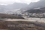
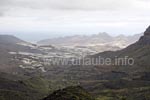
The drive through San Nicolás offers in total a wonderful sight. It seems to be a city of purely local people not assigned to the tourist's view. Everywhere, the washed clothes are hanging for drying from the balconies and it appears that nobody wants to adorn the picture of this place with flowers or other kinds of decoration. It is a pure place, where the inhabitants of Gran Canaria live; There are indeed some guesthouses and possibilities to stay over night for very individual tourists, but no hotels. 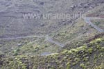
After having arrived at the very bottom in San Nicolás, the road turns and one is driving the mountain up again at the other side of the valley. At the lowest point, one passes Puerto de la Aldea. From here, only a few metres are left up to the beach - a welcomed opportunity to recuperate a little from the curvy drive until then before continuing steeply up the serpentine roads. The further drive on the GC-200 passes a superb view point, the Mirador El Balcón. Up to this view point one still has a view back to the heartland from the hillside. It is possible to see San Nicolás from the other side and one of course also sees where one has been driving through during the last hour. The view point El Balcón is a place where one can stay a while. The views down the cliff line of approximately 600 metres depth are totally fascinating; one hears the surge and the wind. One has to step down a couple of stairs in order to stand on the actual Balcón and enjoy this gorgeous view. 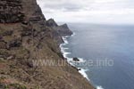
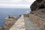
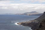
By looking from the Mirador El Balcón in northern direction, the next point of our island tour gets visible, Puerto de las Nieves. But there is a considerable way to drive in order to get there. The further driving is marked by this view to the further coast in front of one, whereby one has repeatedely the impression to be so close to the next places. But this view cheats, as one cannot see the further continuation of the road. There are repeatedely new curves coming out from the hillsides that put the next place, Puerto de las Nieves in a far distance. Unfortunately, during the further driving there are barely possibilities for having a stop and make some pictures. The road is very narrow and curvy so that one simply cannot stop. Puerto de las Nieves: Traditional small Fishing VillageThe drive from San Nicolás passing the view point Mirador El Balcón was tough and exhausting. Puerto de las Nieves is the next big city and we arrive very hungry and with the need of some recuperation from the drive. 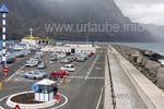
In Puerto de las Nieves, the many still very original fisher houses are completely painted in white. On one hand, we had, by this way, the impression of having arrived in a small village where the time seemed to have stopped. On the other hand, the newly built harbour complex that seemed to be relatively huge, where at that time the car ferry to Tenerifa was docking, nearly seemed futuristic. With this Fred Olsen Express-ferry, one needs approximately one hour until Tenerife. From a small pedestrian bridge, one has a good overview over the harbour complex and the place. One can park straight in front of it. 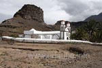
At the coast's side, the whole harbour complex is completely covered with some huge concrete blocks. By this way, the usual romantic harbour atmosphere could not really emerge. But it was fascinating to watch the surge. The waves were beating with power against the concrete blocks. These montruous blocks were not good looking, but they protect the coast against the waves. The view back alongside the coast is spectacular, where one can see the steeply jagged mountains through which one just struggled in countless serpentines. 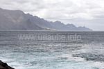
Here in Puerto de las Nieves, we take the opportunity to eat something in one of the restaurants right at the harbour. We were pleasantly surprised as despite the low prices, it was possible to get good and also tasty food. The restaurant, where we were sitting in a semi-opened area protected by a cover, became crowded in a very short time. By the way, it is possible to park the car right at the port in front of the restaurant. In Playa de las Nieves it is also possible to bath, but it is not big fun due to the surge. After having had an abundant and really good lunch, we continued driving in direction to Gáldar. Gáldar: The horrible impression from a distance cheatsThe drive from Puerto de las Nieves up to the place Gáldar is fast and comfortable. There is no more driving on serpentine roads as the drive continues on well arranged roads and before Gáldar, one even gets to the beginning motorway. During the drive, Gáldar is already recognizable from a distance. The lava dome is covered with a variety of coloured houses up to half of the height. This is not really a nice view, as the whole appeared to be very unusual, confusing and trist. But despite of it, the view was fascinating, as Gran Canaria is not as island as Lanzarote, where one is continuously surrounded by lava domes. 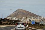
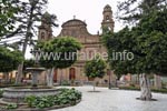
Due to the upper part of the scant hill, the residential areas partly completely covered with high-rise buildings appeared as some upper-leveled concrete slums. Also during the approach, the first impression was: ugly, dingy, aimless. If we had not struggled through the one-way street-muddle up to the original centre, we would have not believed that Gáldar has a very imposing city centre. The square around the beautiful church where the time-honoured guildhall of the 18th century can be viewed is, with its green trees, the benchs and a water fountain, very inviting. This plaza was even set under natural protection in the year 1981 due to its historical meaning and the artful expression. Sardina del Norte and the Light House at the north-westFrom Gáldar there is a small country road in the north-west tip of the island. The way to Sardina del Norte leads through a very trist area. Here, the houses are certainly built at the cliff, but seem to be ruinous in total and the area around the port seems abandoned. There are indeed some restaurants and a tiny beach section, but this windy area did not have an inviting impression to us. 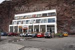
The actually attractive thing of this area is under the water. Many diving schools from the southern tourist areas do specially a side-trip to this place in order to have deep divings in the right proximity of the coast. Also the hillsides steeply falling into the water go up to a depth of up to 15 metres, and this is offered without having the need to get far into the sea as it is the case in other places. By driving down the long extended coastal promenade in Sardina del Norte, one gets to a mole at the end. Here, the restaurant Fragata has specially fish and seafood to offer. 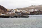
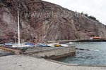
Also the further way to the light house of Sardina is extremely barren. One drives alone on a small country road and there is practically nobody visible far and wide. In this area, still buildings are constructed everywhere, but the available apartments of this area did not seem to be very attractive. We were actually attracted by the idea that we could have looked over to Tenerife from this most north-eastern point. But the way is really only worthwhile if one knows that the sight will be clear. Otherwise, one is really deterred by this area. 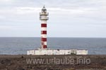
The light house is strongly bedraggled. It rather reminded me on a pillar of a wasteyard covered with graffitti. What a pity. There was no way to get a romantic atmosphere at the light house. But finally, the purpose of our tour was not to experience some special highlights. In this side-trip to the northwest we got introduced to an area that has not been tuned yet for touristical purposes and due to this reason,, it unfortunately also was of very few charm. Cenobio de ValerónThose who want to finish the island tour in Gáldar can get quickly back to the south over the motorway. In approximately one hour, one is back home at one's Hotel in Playa del Inglés or Maspalomas. But the north of Gran Canaria offers some highlights that can be only experienced outside the motorway, by continuing driving on small country roads. By this way, one gets to Cenobio de Valerón. 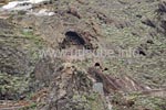
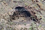
Cenobio de Valerón is located a little more to the east of Guía. On the small country road GC-291, one passes straight the more than 300 caves that are engraved in the rocks. The best is to follow the signpostings of the country road. Unfortunately, the caves were closed on Mondays. It is possible to get up the stairs up to the cave system, but the actual viewing in the interior is not allowed. The adjacent picture shows a close-up from the street where the whole stair is recognizable. Arucas and the Montana de ArucasAs the last station of our island tour we visit the city Arucas with its mountain hill. Arucas is practically located on the way, and from there one also gets quickly back to the south of the island. The special attraction of Aruca is the monumental church San Juan Bautista that rather reminds on a cathedral due to its size and impressive arquitecture. 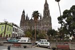
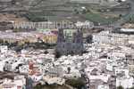
The distinctive dark lava stone that was used for the building of the church is cultivated in the area of Aruca. Also the houses that are in the immediate proximity of the church were made of this material. The oldtown is completely under monument protection. The pedestrian area and small alleyways in the centre accommodate beautiful old small houses with intensive colours of their claddings. A small walk in Arucas is indispensable. 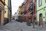
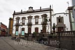
Originally, the area of Arucas was very rich in water and wood resources. Due to the extensive sugar cane cuiltivation, the wood was mainly removed and burned for the destillation of rum. When in the 16th century the Caribbean competition could provide the sugar cane to the market to a considerably cheaper price, Arucas rearranged its orientation. The cochineal louse with which red clourants were gained made it possible that the economy continued booming up to the 19th century; Not until the synthetic production of colourants, it was again time to re-orientate so that the area completely adopted to the lucrative cultivation of bananas. Still today it is possible to take part in the historical changes. In Arucas, it is worthwhile to visit straight two museums. First, the stone pit with the chiseller museum can be viewed where the dark lava stone is already cultivated since the 16th century, and the other attraction is the rum distillery, where rum and banana liqueur is produced. Still today, this factory is an important employer in this area. 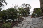
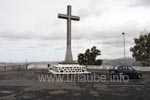
One gets to the Montana de Arucas, which top is decorated by a big cross, by car over some small and narrow alleyways through the city. But the signposting leads one safely to this place. The actual road to the mountain is wide enough and after three rounds, one is already on the huge parking place. From here, one already has several view points to choose, as it is possible to look into all directions. From here, one has a straight view to the capital of the island Las Palmas and Arucas right at the front. This place is apt for resting for a longer time. The big restaurant offers space for a lot of excursionists and the appendant terrace is so nicely arranged with the many plants that one feels like staying here for a while. The Montana de Arucas is THE view point of the north of Gran Canaria par excellence, thus an absolute highlight. Conclusion of the Island TourOur island tour ends at this spot. We are on the way from the early morning and just want to go home. From Arucas we needed approximately one hour up to Maspalomas. As soon as one left the place, one quickly gets to the motorway on which it is possible to drive through up to the south of Gran Canaria. In total, we made more than 150 km this day. But what is decisive is not the amount of kilometres but the driving time: while the drive in the north of the island and back to the south on flat an wide roads was quite fast, the average tempo in the west of the island was rather in the margin under 50 km/h. The time needed for some few kilometres was respectively long. For the island tour described on this page one has to plan approximately one day; At the end one is quite exhausted from the driving and for the next day one should plan a resting day on the beach in order to recuperate from the excursion and to assimilate the many impressions. Back to the index Gran Canaria Copyright: Patrick Wagner, www.tourist-guide.biz |
||
