Gorner Glacier and Gornergrat

From the many glaciers in the mountains around Zermatt, the Gorner Glacier is the most famous one. While the two other major glaciers, the Zmutt Glacier and the Theodul Glacier, are glaciers to be looked at from all perspectives from a distance, the Gorner Glacier is a real glacier to get your hands on and to explore from the glacier-fed up to the glacier brook.
Trip to the Gornergrat with the Gornergrat-Monte-Rosa-Bahn
At the most eastern side of Zermatt, already two big glaciers fall into the deep at the right and the left side of the Monte-Rosa mountain: at the left of the Monte-Rosa-Group, the Findelen Glacier and at the right of it the Gorner Glacier. Between these two glaciers, a long extended mountain ridge arises up to the Stockhorn; further above, the ridge then completely disappears under the glacial ice. This ridge is called Gornergrat and the legendary railway that conquers this mountain from Zermatt is called Gornergratbahn or also Gornergrat-Monte-Rosa-Bahn.
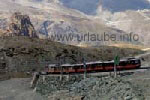
A trip with the Gornergratbahn is an absolute must for each visitor of Zermatt. Also, most of the one-day-tourists include a trip on the Gornergrat in their sightseeing program. Of course, it is a very comfortable thing to arrive to the common main station of Zermatt and have only to cross the street in order to take then the next train in direction to the peak. A two-way to the Gornergrat train ticket costs approximately 40 € per person - a high price for a train trip of barely 10 km.

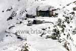
Recently, the Gornergratbahn celebrated its hundredth birthday; it was accomplished in the year 1898 and put into service. Even if the railway trip to the Gornergrat is expensive, at least it is very good fun and the memory of this trip will be long lasting. The trip will be fully enjoyed by considering two tips: by sitting in direction of the train at the right, during the up drive of the mountain, one will have the best views down to the valley and does not have to look over the other passenger's heads. If one additionally sits in the last car of the train, it is possible to picture the train during the curves and watch it wiggling through them. The windows of the train can be opened, so that it is possible to make wonderful pictures.
One has hardly left the main station of Zermatt when one is already rewarded with the first beautiful views: one looks over the little city Zermatt away up to the peak of the Matterhorn. And suddenly, at the tight side, it goes down deeply and steeply to the valley, the train crosses the Findelenbach-Viadukt, that is more than one hundred years old and to which can be gazed it already from Zermatt. The 40-minutes-trip up to the Gornergrat is not a non-stop-stretch at all; en-route, the train does a total of 4 stops. The first stop is made at the station Findelnbach, from that one can do a nice one-hour-tour across to the Grünsee.
The train does a second stop at the station Riffelalp that is located at a height of 2222 m, where the same named hotel resort is situated. A little tram, the shortest at highest located of Switzerland, forwards the guests the half kilometer across to the hotel. Actually, one should get out here and continue on foot, but the coming stretch by train should also not be missed, as now, the train wiggles up in the free area further to the station Riffelberg that is located at a height of 2582 m. Here is also a same named hotel with a nice garden restaurant. From here, the view across to the Matterhorn is already breathtaking, but it will get better.
The train does a further stop at the station Rotenboden (2819 m height). From here, there are only a couple of minutes to the idyllic Riffel Lake, in which, provided the day is clear and there is calm, the Matterhorn-Pyramid reflects impressively. Here, also experienced climbers get out of the train in order to get in two hours to the 2795 m heighted Monte-Rosa-Hut and, maybe on the next day, dare to try to get to the 4634 m heighted Dufourspitze.
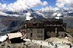
Finally, after a trip of barely a three-quarter hour, one gets to the station Gornergrat at 3089 m height. During my first Zermatt vacation, I was shocked here by the masses of tourists. At the big station, it swarms as on an anthill; photographers hinder each other and the one-day-excursionists divulge some bustle. Under these circumstances it is difficult to concentrate on these fantastic views.
From the railway station, one still ascends 40 m to the Gornegrat-Peak that is located at a height of 3130 m, before one fully dedicates one's gazing to the mountain world. One does not know in which direction one should look first; of course, the view goes first to the lonely standing Matterhorn, that from this altitude does not look so nice as from the valley. Amidst a rocky and frosted landscape of high mountains, the peak does loose some idyll; as a white pyramid in the background of a green valley it somehow seems more beautiful and fabulous.
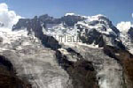
At the right of the Lyskamm-Group, there is the Breithorn group. From the Gornergrat, one can nicely recognize each of the peaks and glaciers. At the very right, there is the Klein Matterhorn (3883 m) and the Breithorn (4164 m). Between the Breithorn and the Ostspitze (4159 m), the Breithorn Glacier extends down the ridge. The Breithorn-Twins and the Roccia Nera follow, thereunder the wide Schwärzegletscher.
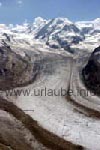
According to my opinion, what is much more impressive than the view to the four-thousanders is the view down and across to the Gorner Glacier; only now it gets really clear how big this glacier is and the ice and scree masses that are transported downhill. The Gorner Glacier is practically originated between both of the more than 4500 m heighted mountain groups Monte Rosa and Lyskamm and flows down the valley up to the glacier gate to which we will get later on.
Those who are having a trip on the Gornegrat during the first day in Zermatt will probably gaze at the mighty mountains and the glistening surrounding glaciers. But those who know and already made some hinking tours will recognize many paths and stations that they already passed. What is specially traceable is the lake walking at the ridge in the front: one clearly sees the stations Sunnegga, Blauherd and Rothorn and one also recognizes the hiking paths and the bathing lake Lago di Lei beneath Sunnegga.
Hiking tour to the glacier gate
After we went up with the Gornergratbahn very close to the Gorner Glacier in order to be able to gaze at it comfortably from above in its mighty size, it is time to "touch" the glacier. We do a hiking tour from the station Furi up to the glacier snout of the Gorner Glacier.
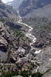
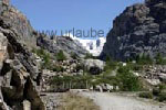
Here, I have to mention a very nice thing that happened during the hiking tour in the mountains of Zermatt. I saw the hiking tour to the glacier gate described in a hiking tour guide, but it was supposed to be one of the most beautiful hiking tours that we ever made in Zermatt. During the tour to the glacier garden, we found a sign that indicated the direction to the glacier snout. The curiosity was strong and our water reserves sufficient, so that we simply marched in this direction. Actually, one does not need any hiking guide in Zermatt, one can simply move on and follow the signs; by this way, one is permanently on an exploring tour and ready to be surprised about what will happen during the day, as there are an abundance of stations for a comfortable and fast return.
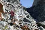
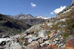
There is one question I would like to answer briefly in advance: what exactly is actually the Glacier Snout?? A glacier is fed with fresh snow at the very top of the mountain and slowly flows downstream. In the warm valley, the glacier melts and the milky glacial water flows as a glacial brook down the valley. At the spot where the water leaks at the glacier tongue, a hole is often generated that is then called the glacier snout. Thus, the glacial milk leaks at the bottom side of the glacier from the front.
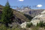
The hiking tour in the Gornertal takes place in a glorious mountain scenery, as it could not be more beautiful. On the wide path, one always walks upstream alongside the little river. Farther back in the valley, the path gets very narrow but still its very good to walk on. One has repeatedely to do a stop in order to enjoy this gorgeous nature. The Lyskamm (4527 m) comes closer and closer; but the views downstream are more impresive than the ones in direction to the glacier. The peaks of Ober Gabelhorn, Wellenkuppe and Zinalrothorn seem to be even more beautiful and glorious after each curve.
Finally, also the mountain path ends and one has to clamber up over stones the last metres up to a big rocky locking bar. In the meantime, the glacier indeed withdrew up to this high rock face, but one arrived to the end of the Gornertal and left a wonderful hiking tour behind. The glacial water is, by the way - how could it be different - ice cold; one continuously gets close to the river in order to take some "samples of water".
Hiking tour to the glacier garden
e made the hiking tour to the glacier garden together with the tour to the glacier gate described above. Actually, only the half-hour circle hiking tour was planned from the Furi to the glacier garden and back by another way. The side trip to the glacier garden that is described above cost us further 1,5 hours, but it was worhtwhile. The glacier garden is reachable form the Furi on a comfortable hiking path, that can be easily walked also by kids. And those who do not want to do the whole stretch at once, will find on the way and at the destination place a picknick station, where one can have a snack in a shady place.
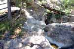
What is actually the glacier garden, what is there to see? Already on the way to the glacier garden, the nicely smooth polished rocks repeatedely attract one's attention. Well, it was not a glacier that had been working there, was it? Yes, it was! It is not so much time ago when the Gornergrat Glacier widely extended down to the valley, so that the mountain farmers were even afraid that it would swallow all their land and huts.
After all, one finds relicts of this glacier period in the glacier garden. The rounded down rocks have a polished surface from the glacial ice. The kettle basins are rotund holes in the ground that once levered out the avalanching glacial water out and polished it smoothly. Over some safe wood bridges, one can get very close to the kettle basins and even get into the rocks and descend them. The glacier garden is smaller than I expected but one gets to see in a very impressive way what a glacier can cause and accomplish in the course of the time.
Hiking tour through the wildly romantic Gorner canyon
Now we have visited the Gorner Glacier at the very top, hiked alongside the Gorner brook up to its glacier snout and saw its former manipulations in the glacier garden. A further highlight offered by the glacial brook is practically located right in front of the entry door. Before the Gornerbach (Gorner brook) gets united with the other glacial brooks resulting in the Matter Vispa, it falls into the Gorner canyon umpteem metres deep into the valley.
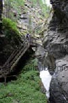
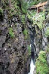
The Gorner canyon is reachable from the centre of Zermatt within half an hour on a wide hiking path. The path is well signposted, one simply continuously follows the cable way Glacier-Express. At the entry to the Gorner canyon one has to pay approximately 3 €. Then, a half-hour hiking tour over bridges, stairs and narrow paths alongside the rocks follows. It goes indeed deeply into the canyon, but the way is always very well secured so that it can be also accessed by families with children.
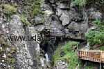
In the course of the milleniums, the Gorner brook digged itself into a deep canyon into the rocks. The water falls downwelling into the depth. At some narrow points, the flow speed is so high that one nearly becomes dizzy by looking at it for a long time. Where the water is really torrential and falls deeply into the depth, the noise of the sputtering and raving is so loud that it is hard to mantain a conversation. Those who think that the hiking tour through the Gorner canyon is a dry matter, as the water flows deeply under oneself, are wrong! One repeatedely gets dredged with a fine drizzle; I found these little refreshings to be very pleasant and calming.
After half an hour, one gets out at the other side of the canyon. There are several ways back to Zermatt (but also further up the mountain). We went back over the little hamlet Schöner Boden and Winkelmatten and have looked at the nice houses and sheds. The tour to the Gorner canyon is, by the way, also an ideal tour for a bad weather dayg, as in the canyon it does not play any role if the sun is shining or if the sdky is clouded; anyway, one barely looks over the rock faces.
Crossing the glacier to the Monte-Rosa-Hut
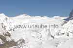
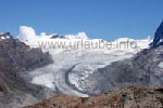
We already touched the glacier during the hiking tour to the glacier gate. But those who really want to get in touch with the Gorner Glacier have to cross it: from the station Rotenboden, located at a height of 2819 m, a path leads more or less over to the Monte-Rosa-Hut that is located at a height of 2795 m.
After half an hour, one gets out at the other side of the canyon. There are several ways back to Zermatt (but also further up the mountain). We went back over the little hamlet Schöner Boden and Winkelmatten and have looked at the nice houses and sheds. The tour to the Gorner canyon is, by the way, also an ideal tour for a bad weather dayg, as in the canyon it does not play any role if the sun is shining or if the sdky is clouded; anyway, one barely looks over the rock faces.

Back to the index Zermatt
Copyright: Patrick Wagner, www.tourist-guide.biz
|