 |
The hiking and view peak Rothorn

Most of the times, the Matterhorn is named in the same sentence with Zermatt and is, of course, the emblem of the place. But if I had the honour to choose another one of the many peaks around Zermatt as the local mountain of the little city, I would take the 3103 m heighted Rothorn. The Rothorn itself is indeed neither a famous four-thousander nor a special sightseeing as the mountain itself, but it is located right at the valley of Zermatt; from the Rothorn, one can look straight away deeply down into the valley. Of course, one can also look up from Zermatt straight to the Rothorn. Even the big Rothorn gondolas between Blauherd and Rothorn are visible floating in the air.
And another reason why I would choose the Rothorn as the local mountain of Zermatt is that one does not need to be an extreme climber to climb it up, but a good and well conditioned hiker, if starting from Zermatt. But there are also the mountain railways...
Trip or hiking tour to the Sunnegga
A wonderful hiking tour leads from Zermatt over the Weiler Ried and Tuftern to the Sunnegga at a height of 2300 m. As Zermatt itself is located at a height of 1620 m, one has to ascend the mountain for 680 m. On this stretch, either in Ried as also in Tuftern, there is the possibility to have a refreshment or a snack. The ascend to the Sunnegga is rewarded with very nice views down to Zermatt. Sunnegga means, by the way, something like sun cover.
It is also possible to get to Sunnegga from Zermatt with the Alp metro Sunnegga within 10 minutes. This funicular raises straightway up across the mountain. On half-way, an encounter with the opposite train follows at a short switching place. When I had my first trip with the Sunnegga-Express, I was very surprised about the fact that the train does not reduce the velocity at all when the opposite train comes and I needed some time to find out why these both trains pass each other with such a high velocity and then find exactly the right time where the short double-tracked piece is: both trains hang from one single cable; if the cable moves, one train moves upwards and the other downwards. Thus, it is a kind of lift structure: the trains maintain the balance through the pulley, the motor has only a "little" work to do.
In the guesthouse Sunnegga I had the best rösti ever. The views from the Sunnegga are already fascinating, but can be a little foretaste of what is waiting for one at the Rothorn.

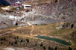
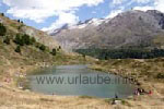
Only a few metres underneath the station Sunnegga, there is the Leisee. It sounds unbelievable but in this lake it is possible to bath. Thus, is the local bathing lake of Zermatt located at a height of 2300 m? The temperatures must be very high since a certain period of time so that the water gets an acceptable temperature. But during the hot summer 2003, one could fantastically bath in the Leisee. It was a pure pleasure to lie at this lake, enjoy the world of mountains and get refreshed at the water from time to time.
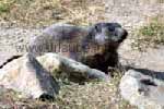
The place Sunnegga is also known for its marmots. A little beneath the station, there is an observation post for marlots, where one can unhurriedly watch the marmots during eating and sunbathing. But these little marmots should not be disturbed; they immediately escape to their house when they feel in danger. If one gets too close to the marmots, their loud warning whistles, what means something like "Be careful, there is danger, everybody go back!".
From the Sunnegga to the Blauherd
From Sunnegga, a well arranged hiking path leads up to the Blauherd that is located at a height of 2601 m. Of course, for this short stretch there is also a gondola that takes one comfortably to the Blauherd. But this short hiking stretch has a speciality and this is the reason why families with children specially like to walk it: many marmots accompany the hikers on their tour and they have get do used to them that partly, they even are hand fed by the visitors.
Trip or hiking tour from the Blauherd to the Rothorn
Those who already hiked from Zermatt up to the Blauherd, have done their job of the day with 1000 m altitude. After such an exhausting mountain tour, further 500 m altitude up to the Rothorn could follow, but the way is sunny and therefore very exhausting. Of course, it is more comfortable to do this with the Rothorn-aerial cableway. Both Rothorn-gondolas are the biggest ones that I have ever seen. If two full travel buses would arrive at the Blauherd at the same time and all passengers would get in one of the gondolas, there would be still enough space for a lot of hikers.
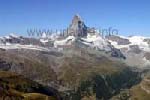
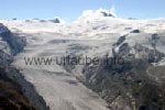
Once arrived at the Rothorn, one is spoiled with views so that first it takes one's breath away. Where should one look first, down to Zermatt, over to the Matterhorn or up to the Findelen Glacier? One should stay at the Rothorn for an hour, in order to spoil one's eyes. Of course, one can also spoil one's stomach at the same time by sitting at the outdoor terrace of the guesthouse and ordering something to eat.
Of course, one first unhurriedly looks over to the mountain of the mountains. Even if one has already seen the Matterhorn several times from other view points, the view from the Rothorn is something very special. One looks straight into a flank of the summit, thus, one sees two sides of the mountain in symmetrical order. But what is much more impressive than the summit itself is the area underneath the summit. One can see on the wide basement where the Matterhorn has its fundament. And, of course, one also sees the station Furi, the Schwarzsee and the Hörnli-hut, by looking closer. At the right of the Matterhorn, the Zmutt Glacier is already visible and/or its moraines.
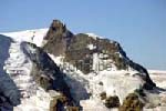
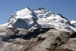
Right underneath the Matterhorn, Zermatt is visible. How tiny the little city seems to be from here above! Then a pan to the left and one looks up to the Cima di Jazzi. An impressive wide glacier surface, where the glacier is fed, gets into the Findelen Glacier and flows downstream. The Findelen Glacier is from above at least as impressive as the Gorner Glacier viewed form the Gornergrat.
But these are not all views. In principle, one sees from the Rothorn the same panorama as from the Gornergrat, but it is only a slightly different perspective. Of course, the eyes have also to be fixed to the Klein Matterhorn, as one probably already has been there. From here, one can really see the huge stretch the cable way travels, in order to disappear completely at the very top into the summit.
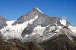
Of course, one also sees the Gornergrat itself. From Rothorn, one sees what a massive mountain ridge the Gornergrat is. This is why it also blocks a little the view in direction to the Lyskamm, Zwillinge and Breithorn. But form the Rothorn, one there is a straight view to the Weisshorn that is located at a height of 4506 m at the other side of the Mattertal, and the Weisshorn seems to be even bigger, as one sees the mountain at once from the peak to the valley.
Those who want to beat the views and the height from the Rothorn, will find a way down and up to the Oberrothorn at a height of 3415 m. One can also spend a lot of time at the Rothorn, by the way, by watching the paragliders starting. It is unbelievable how the paragliders, shortly after the start, fastly gain altitude over this mountain ridge as rockets.
Hiking tour to the Stellisee and to the Fluhalp
Between the stations Sunnegga, Blauherd and Rothorn, there are countless hiking paths on which one can spend full days. An absolute must is the hiking tour to the Stellisee and to the Fluhalp. The most comfortable is to start this tour from the Blauherd, as then one walks on an almost constant altitude. But also from the Rothorn or from the Sunnegga this tour can be started.
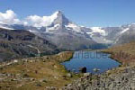
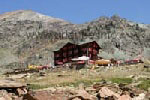
The Stellisee locted at a height of 2536 m is an idyllicly located mountain lake, in which the Matterhorn reflects in a very impressive way. But in order to recognize a real reflection, two conditions hace to be fulfilled: it must be absolutely windless so that the wind does not generate any waves, and there should not be any kids or dogs playing there. As the Stellisee is a real destination of family excursions, the second condition is practically never fulfilled in the afternoons. On this hiking tour, one is also never alone, one nearly walks in groups.
Not until one walks upstream in direction to the Fluhalp, the families with kids are left behind and one finds the longed quietness and isolation. By each further meter walked, the view back to the Stellisee gets more beautiful. The way to the Fluhalp leads through an impressive area, the 4527 m heighted Lyskamm gets increasingly closer. Finally, one arrives at the panorama restaurant, where one can have a meal and enjoy the views at the same time. And at this altitude, the meal was fantastic, I still remember this today!
By looking at the tour done until now at the map, it is recognizable that now, one arrived to the very back at the valley and that one is standing right at the bottom of the Findelen Glacier. There is nothing to be said against walking the same way back. But for those who have still some hours time, I recommend continuing walking to three further lakes between Rothorn and Gornergrat. This tour is also called the 5-Lakes-Hiking Tour.
Grindjisee and Grünsee
From the Fluhalp or from Stellisee, it first goes deeply into the valley, either on a wide hiking path or on a slightly adventurous tightrope walk. Once arrived down in the valley, there is still a large loop way to take in order to cross the Findelnbach. In case the tide is low, there are also some short cuts, but then one risks to get wet feet. The first mountain lake on the way is the Grindjisee. What an idllyc, the Grindjisee. Also in this lake, the Matterhorn is reflected in case of a calm, but thanks to the surrounding trees there is a complete different atmosphere. The lake is not warm, but is it possible to dip the feet into the water in order to get refreshed. On the way, one has already seen that a brook flows straight from the Stellisee and disembogues in the Grindjisee.
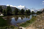
The Grindjisee is a real place to picknick, where there are also barbecue stations. Contrary to the Stellisee, here, one finds quietness and can unhurriedly look at the water reflections. From the Grindjisee, one can walk further downstream back to the station Sunnegga or ascends a few more altitude metres in order to get back to the Blauherd. But now, after having already seen three lakes, the most famous one is missing, the Grünsee.
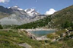
The Grünsee is located at a height of 2296 m; thus, we have to walk again from the Grindjisee a few metres up. But these metres are worthwhile, as the Grünsee is beautifully located, and the best is that one can have a bath in it. Lucky those who took some bathing short to the tour, the others can at least hang their feet in the warm water.
 Thus, those who do the 5-Lakes-Tour should in any case put a bathing suit into the rucksack, as either the Leisee as also the Grünsee invite to have a bath. A little beneath the Grünsee there is the Grünsee-restaurant.
Now there is to decide in which direction to continue, as there are two main possibilities: in approximately one hour, one can walk over from the Grünsee to the Gornergrat-railway-station Riffelalp. The way is practically even, very wide and well secured. But there is still a 5th lake between the Gornergrat and Rothorn to discover, the Moosjesee. If one walks down from the Grünsee through the dense and shady coniferous forest, this lake is passed and one gets to the beautiful hamlet Findeln, where one can gaze at some aged little houses of the Walser that are still occupied. Thus, one crosses here a piece of the old history of Zermatt.
From Findeln, there is again to decide how the tour is to be continued. The way of approximately one hour alongside the valley to the Gornergrat station Findelnbach is comfortable, from which one can also walk down to Zermatt. The ascend of approximately 250 m altitude back to the station Sunnegga is a little more exhausting. But, as known, there is still the Leisee, where one can have a bath after a long lasting and exhausting tour.

Back to the index Zermatt
Copyright: Patrick Wagner, www.tourist-guide.biz
|
 |