|
|
|
British Columbia's EastRocky Mountains and Columbia Mountains 
In the eastern part of British Columbia the landscape becomes mountainous and diversified. Stop 4 leads to Banff and Jasper National Parks with fantastic sights such as Lake Louise, the Columbia Icefiled glacier and Athabasca Falls. Stop 4: Banff National Park / Jasper National ParkWe continued on the Trans Canada Highway over Rogers Pass, 70 kilometres away and situated at 1,327 m over sea level in the Glacier National Park in the Columbia Mountains. Human existence plays absolutely no role here, and "whoa" can only remotely express the things going on in our heads. Anyway, we did not think much more. After another 150 kilometres of pure astonishment we left behind Kicking Horse Pass (1,643 m) and reached Banff National Park in the province of Alberta. It is the only province in Canada without an own VAT, but smuggling alcohol and tobacco to other provinces is persecuted here as well. Having arrived in the Canadian Rockies, we left the Trans Canada Highway and moved on in north-western direction on the Icefields Parkway, one of the world's most beautiful dream roads offering unforgettable sights in all directions and in the course of which Sunwapta Pass (2,035 m) links Banff and Jasper National Parks. 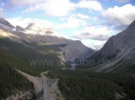
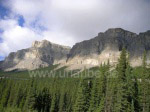
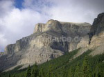
The landscape is now characterized by jagged, snow-covered mountain peaks, glaciers shimmering blueishly, thick coniferous forests and wide plains that are crosses by turquoise flows (Sunwapta River, Athabasca River, Miette River) and lakes. It was at latest now that binoculars and camera (never forget them, please!) were constantly at hand as the animals mostly were only to be seen at a safe distance; White head eagles, Rocky Mountain goats, bighorns and Wapitis could easily be spotted from the road, the latter not seldomly coming near the streets in the national parks and thus representing a considerable traffic risk. 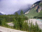
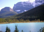
A guarantee for interesting observations always were vehicles parked next to the road with people standing next to them and all looking in the same direction with their binoculars. Tip: Just drive near and ask; for example, I was the only one to spot a herd of mountain goats on a mountain slope, and other tourists - not in the least my own group - were thankful for this. Viewing platforms and lay-bys, however, offer the best way of observing, enjoying and having a snack without being disturbed, and there are lots of them; At the meeting point of Trans Canada Highway and Icefields Parkway, we found the first (and one of the most famous) of the sights in the Canadian Rockies, Lake Louise. Lake Louise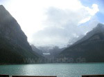
The first look at Lake Louise is simply breathtaking. The lake has been carved out of the mountain 70 m deep by a glacier that still aliments it today, and also its brilliant turquoise colour is due to the glacier that sends, along with melt water fine stone powders into the lake that reflect the sunlight. Steep cliffs, several hundreds of metres high, surround the lake situated at an altitude of 1,536 metres; the glacier sits on the mountain on the narrow side of the lake. Opposite lies Château Lake Louise, a five-star hotel that looks like a foreign body in the scenery in spite of its delicate architecture and that is departing point for many hiking tours and climbing expeditions. For a moment, I was wishing I could make the crowds of tourists (in summer, some 10,000s per day) and the multi-level hotel temporarily vanish to be able to imagine how things might have looked before the beginning of tourism. Columbia IcefieldAfter 100 more kilometres on Icefields Parkway, which every now and then is bordered by rivers, steep water falls and giant mountains formed by erosion and presenting themselves in permanently changing sunlight, we hardly knew what more pictures to take. Just behind the next bend in the road, there could be a view that was perhaps even more beautiful than all others before. It is a strange thing how much pressure one exerts on oneself by thinking of capturing all impressions and not even remotely thinking of the best idea - just putting the camera aside. 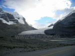
Finally, Columbia Icefield on Mount Columbia, Alberta's highest mountain with its 3, 747 metres, appeared. The glacier, one of the larges ice masses south of the polar circle sits over a desert of rubble; it is alimented by seven glaciers and has a thickness of up to 350 metres; Experienced hikers take the walking path from the parking lot to the ice field and can, guided by signs, witness the slow decrease of the ice masses. In the same way, the treacherous crevasses are bluntly refered to that lurk away from the marked walking path. Children that lost their lives in these crevasses are depicted on signs that serve as memorials now. Their names and dates of death are mentioned as well. Staying on the path, one can enjoy a magnificent panoramic view surrounded by mountains over 3,000 m high, of which there are ten around. The walking path, however, is steep and - also because of the thin air - exhausting. We only realized how far we had really walked, how many metres in altitude we had done and how glad we were that the way back would lead downwards when arriving on the glacier. The buses on the parking lot looked tiny, and the way up must have taken us about three quarters of an hour (without breaks). Summer tourists also have special buses (snow coaches) at their disposition that drive up from the valley station to the glacier . Athabasca Falls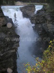
After having followed a big Wapiti into the scrubs armed with a camera to shoot a lousy, much too dark picture of his behind, we drove on for another 70 kilometres to the Athabasca Falls. Situated a short distance away from the Icefield Parkway, the powerful foaming waters of the 1,231 kilometre-long Athabasca River that is alimented by the Athabasca Glacier of the Columbia Icefield fall into a narow, 23-metre-deep ravine. It is not the height in itself, but rather the pure natural power that becomes visible which impresses here, tons of water squeezing through a tiny needle eye in the rocks and thus forming and carving them into bizarre shapes. In the course of some million years, a steep canyon was formed that offers interested hobby-geologists interesting insights to the different layers of stone. For people suffering from acrophobia like me, looking down into the ravine from a little bridge is probably among the most horrible, but also most impressing and authoritative things on earth. The protective rail, in any case, could not have been high enough. During summer, whitewater rafting tours through the Rocky Mountains start downriver of the Athabasca Falls. 
Back to British Columbia table of contents Author: Ingo Schmidt; Copyright: Patrick Wagner, www.tourist-guide.biz |
||