|
|
Tour in the north of the island Lanzarote
The northern part of Lanzarote is more mountainous and cliffy than the southern part of the island. There are more rainfalls so that the landscape is clearly greener and more vegetated than the rest of the island. Our tour in the north passes over a number of fantastic view points where one can enjoy some breathtaking views that will not be forgotten in a lifetime. 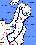
We start the tour in the former capital of the island Teguise and drive then at the west side of the island, partly at a high altitude, to the northern tip, where the Mirador del Río is located. We drive back at the east side, rather at sea level, where we sae several sightseeings subterranean and/or on the ground. Of course, this tour can also be made in opposite direction and be started from a different location. It is a full day tour with lots of highlights. I made the tour three times, as one cannot percept so many impressions at once. Moreover, by watching the landscape from the view points in different day times and sun radiation, it glistens in completely different colours. TeguiseUntil 1852, Villa de Teguise was the capital of Lanzarote; When in the 15th century the town was built in the upcountry, rather the economical aspects (a harbour) were in the foreground than the security against the pirates and bandits. This is why simultaneously, also in the mountain Montaña de Guanapay, a fortification was built for the protection of the inhabitants and also as a view point in order to notice arriving pirates in time. But the fortification as a shelter was only reserved for the lords, the simple people had to escape to the caves Cuevas de los Verdes. 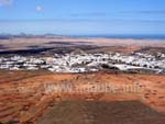
Those who live in one of the big tourist centres of Lanzarote or even in the capital of the island, will notice soon that all houses and buildings are new; Not a bit of historical buildings. Not so in Teguise: today, the city is so well worth seeing, as there, the historical building substance of the late medieval times is conserved. Teguise is a city where one simply parks the car to have a walk for a couple of hours through the old little alleys. The beautiful and harmonical place Plaza de la Constitución is worth seeing with the church Iglesia Nuestra Señora de Guadalupe. Here, the antiquarian coziness comes up. But the main sightseeing of the city is the old dynasty Palacio Spinola. While during the week, there is an ethnic calmness in Teguise, there is hustle and bustle on sunday morning, when the big market takes place. Basically, this market is a big tourist spectacle, where many things are bought that come from anywhere except from the island. But despite of this, this sunday market is worth to visit. 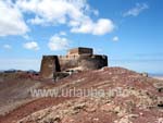
Those who go to Teguise on a sunday will experience some hype and crowds; those who visit the old capital during the week will find calmness and cozyness. The same applies if one drives up to the Castillo de Guanapay that is located at a height of 447 m. While on a sunday, one has to park the car somewhere on the access road, during the week it is possible to drive practically up to the rope bridge. The little fortification itself does not offer any interesting features, a little museum in the interior can be confidently discarted. But what should not be discarted at all is the fantastic view that is available from the volcano peak with a height of 447 m. The view is allround so that one can see all parts of the island, even the capital of today, Arrecife. One gets the best views by surrounding the volcanic vent on its crater edge in a march of approximately 15 minutes. Los VallesAfter the visit of Teguise and its Castillo, we continue driving in direction to Haría alongside the north west side of the island. Here, there is the second oldest part of the island, the Risco de Famara. 10-15 million years ago, this part of Lanzarote was still a separate island (see Origination of the island). The Famara mountains are at least as spectacular as the national park Timanfaya. In order to get from Teguise to Haría, first the ridge has to be driven up in order to get in Haría back to the valley of 1000 palms. 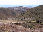
A serpentine road at Risco de Famara in the area of Los Valles goes up again. The little area was founded after the volcanic catastrophies of 1730-1736. During the drive to Los Valles one rapidly notices that here it rains from time to time. The Famara mountains is the only region of the island with a natural water resource. The drive up between the dry cultivation fields is wonderful and ends at the Mirador del Valle. Here, an old finca was converted to a panorama restaurant. Thus, one can enjoy national food with some fantastic views to the valleys (Los Valles). Mirador Ermita de las NievesIn Los Valles, after having drove up to the Famara mountains at a height of approximately 600 m, one can really look forward to some fantastic views during the rest of the stretch. First, one passes the Parque Eólico de Lanzarote (a windpark with approximately 50 wind rotors), that somehow does not match at all into the natural landscape image. I also only mention this windpark due to the reason that not far behind it, a very narrow side street exits that leads to the Ermita de las Nieves. 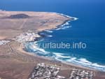
This inconsiderable side trip should be done in any case. Although the street is narrow, it is good drivable. First, one enjoys the view down to Los Valles before getting to a little pilgrimage chapel (= Ermita). But the snow chapel (= Ermita de las Nieves) is only a kind of signpost and/or a place where one parks the car, as what is a few metres further, is breathtaking: the Risco de Famara falls approximately 600 m deep steeply down into the sea. One can enjoy an unique view to the bay of Famara with its beaches and fisher villages. From the Mirador Ermita de las Nieves, one also sees straight away the highest point of the island, Peñas del Chache with a height of 670 m. Unfortunately, this peak serves the Spanish military; thus it is not accessible. Haría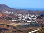
After having passed the highest point of the island, the way continues down into the valley of 1000 palms. From the Mirador de Haría, one already sees what is to be expected from a distance: the little place Haría is situated in a valley, in which there are countless Canarian palms. What a fabulous look, as until then, one only knows Lanzarote rather as a dry island, where fallow lava surfaces and unvegetated volcanic vents dominate. Haría itself is probably the most beautiful little city of the whole island. The important artist César Manrique did not spend his evening of life in Haría for nothing. By drinving into the place, one finds right in the city limit a big parking place at the left roadside. Here, one parks the car in order to explore the village in a march of an hour. Haría does not offer many sightseeings. It is simply a beautiful, cozy village for a little city walking tour. At the Plaza Leon y, there are a few cozy restaurants where one can sit in the shade under the trees. Mirador de Guinate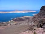
From Haría, the street on the Risco de Famara leads uphill again and after a few kilometres,one arrives to the next interesting place Guinate. Here, there is a view point that is at least equal to the famous Mirado del Río and that in additionally does not cost any entrance fee. The Mirador de Guinate is located at the very end of the road that ends at a little parking place and/or a large turning around area. If more than ten cars arrive here at the same time, there is a chaos of parking and turning. The view from the view point of Guinate is sensational. A major part of the island La Graciosa is already visible. By looking down the rocky cliffs of a hieght of 600 m, one discovers the lonely beach Playa del Risco and the saline basins behind it. At this spot, one should enjoy these dreamy views unhurriedly, as there is not a bit of quietness at the Mirador del Río. In the place Ort Guinate there is additionally the Guinate Tropical Park. In this park that is sized nearly 5.000 m², there are a few hundred kinds of birds from all over the world. There are some nice shows with parrots for children. But the entrance fee (approximately 7 €) is so steep that one better abstains from this attraction. Mirador del RíoFrom Guinate there are only few kilometres to get to one of the most visited places of the island, the Mirador del Río. On a large parking place, at some days there are dozens of travel busses and hundreds of rented cars parked. In order to get to the observation decks, there are nearly 3 € entrance fee to pay at a cash. 
The Mirador del Río is one of the first masterworks of César Manrique and represents exactly the basic thoughts of the artist: nature, technology, and construction can co-exist harmonically. The Mirador perfectly adapts to the rocky cliffs; if there were not the huge panorama windows, it wouldn't be recognizable from a distance. In the cafeteria, it stands out that everything is rounded down; there are no edges and right angles; harmony dominates, even by walking up the spiral stairs or by walking alongside the different terraces. The view from the Mirador del Río is breathtaking. It goes nearly 500 m steeply down to the sea. The dream beach Playa del Risco, to which it gets a one hour march to access, is very attracting. But the most impressive thing is the panorama view to the island La Graciosa. With good visibility conditions, both of the islands that are behind, Isla de Mantaña Clara and Isla de Alegranza, are recognizable. Monte Corona and Malpaís de la Corona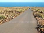
During our tour, already on the way to Haría we were already repeatedely gazing at a huge and distinctive lava dome that dominated the country as a majestic lordliness. It is the 609 m high Monte Corona, that erupted approximately 3.000 years ago (see Origination of Lanzarote). From this gigantic volcano, the massive lava amounts that were disgorged covered the north eastern part of the island that is called today Malpaís de la Corona (Malpaís means, translated, bad country). In the 3.000 years since the big eruption, the nature managed to provide a knee-high bush cover. The drive through this bad country is impressive, if one keeps in mind that on a lava field, not earlier than some hundreds of years later, some braids of a few centimetres height grow that convert the volcanic earth to a fertile one on which then, in the course of some thousand years, some higher plants like bushes can grow. Cueva de los VerdesWhen 3000 years ago the Monte Corona exploded, vast quantities of lava flowed at the north eastern part of the island into the sea. If in a lava flow the upper coat solidifies in the air but the lava underneath still continues to flow, lava tunnels are originated. The Túnel de la Atlántida is, with a length of 7 km, the longest lava tunnel of the world and it even continues one kilometer further underneath the sea level. A section of a length of 2 kilometres can be accessed as the Cueva de los Verdes. 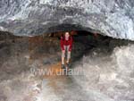
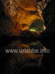
For 6,60 € entrance fee per person, one is introduced to the cave system in a guided tour of 45 minutes. The tours are held in Spanish and english; the comments of the guide are hardly understandable, as on one hand, the groups consist on partly more than 50 people and on the other hand, there are always some little kids giving their comments by screaming. But the Cueva de los Verdes rather impresses the eye than the ear through by commenting. The cave is of four floors; in former times, it served the natives as a protection against the pirates and slave hunters. At the deepest point of the tour, one gets suddenly into a large hall, where concerts are given from time to time. But the highlight is a giant grotto at the end of the tour, where the amazement and shivering that lasted for some minutes turns by a blowoff into surprise and astonishment. Jameos del AguaIn a distance of approximately 1 km to Cueva de los Verdes there is Jameos del Agua. The lava tunnel of a length of 7 kilometres Túnel de la Atlántida, from which the Cueva de los Verdes is a section, is collpased in one spot; such a spot is called Jameo. Again, it was César Manrique who established a memorial by converting a destroyed part of the nature into a dreamscape. For 7,20 € entrance fee, the artwork is accessible. I find this price to be really exaggerated, as the real intention of the master that is to make it a place of peace and quietness, can not be realized at all in this beaten track. 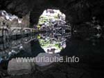
The core of Jameos del Agua is formed by a lava tunnel with a length of approximately 60 m and a width of 20 with its turquoise coloured seawater lake in which little white albino crabs live. As volcanic rocks are porous and permeable to water, the lake is straight communicated with the sea, viz. the low and high tides are also recognizable from the water level of the seawater lake. On both sides of the seawater lake there are some terraces on which one could meditate in quietness if there were not hundreds of tourists around. Beside the lava tunnel there is a beautiful poolscape to visit. This poolscape looks the way one would love to have one in the front garden . Moreover, there are numerous exhibitions about the island, volcanism and a gauging station that permanently monitors and records the volcanic activity of Lanzarote. I found the concentration of hundreds of tourists in such a little lovely place rather deterrent, so that i could not keep a good memory of the Jameos del Agua. ArrietaFrom the Jameos del Agua, we drove back in our tour the coastal road in southern direction. After a few kilometres we arrived to the little fisher village Arrieta. Arrieta is not a specially nice village, but it has a beautiful beach named Playa de la Garita. And what is nicer than relaxing for one hour at the sea after so many sightseeings? Behind the beach there is a little promenade; At the beach itself there are even some changing cubicles. Arrieta itself does not offer any good fish restaurants that are also frequented by many local people. The beach of Arrieta is frequently visited at the week ends, but mainly by Lanzaroteños. Jardín de CactusOn our drive alongside the north eastern coast we suddenly discovered in a place named Guatiza a nicely painted windmill and a big artificial cactus. There should be something! The windmill is a restored Gofio mill (Gofio is a national dish and/or a national ingredient for different dishes), that became an enblem of the island. Underneath the windmill there is a deep cavity, from which in former times dry field cultivation was cultivated. 
After this cavity was shut down, César Manrique made a huge cactus garden of it. The whole complex reminds on an old roman arena with a large field in the middle and tires at the sides. In this complex, there are more than 1.000 different kinds of cactus, partly heighted a couple of centimetres, partly heighted a couple of metres. Most of the visitors are less impressed by the cactus but by the arquitecture of the whole complex. A visit to the Jardín de Cactus costs 3 € and one definitely does this visit as in any case it is in the way. By the way, the Gofio mill can be accessed and also the interior can be visited. Fundación César ManriqueThe coastal road in the north south if the island ends a place named Tahíche at a large crossover. Only a few metres in western direction there is the Fundación César Manrique. Here, the grand artist built his house and lived there until 1987. For nearly 7 € entrance fee one can visit the residence/atelier of approximately 1500 m². But not only the residential and working rooms of the artist are shown, but also drafts, drawings, plans and sculptures that the grand maestro created in the course of his life. 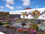
César Manrique built his house and his studio amidst a lava field, under which there are some lava bubbles. He connected these subterranean vugs with corridors and created this way a huge living complex with countless loungues and working rooms. A beautiful little poolscape with a little garden in a depth of several metres is realy tempting to have a relaxing bath. Also in his living house and atelier, César Manrique showed in a very impressive way how good it is possible to unify the nature, the art and the technology. At this point, our tour through the northern part of the island ends. Those who experience the described sightseeings in one day should do in the next day a pure bathing day at the pool or at the beach in order to calmly assimilate all the images in mind. 
Copyright: Patrick Wagner, www.tourist-guide.biz |
||