|
|
Tour in the south of the island Lanzarote
In the south of the island there are some sightseeings and places that are worth to visit and can be comfortably visited during a day excursion without getting stressed. Some people even also visit the national park Timanfaya during the tour through the south; but I prefer to leave some space in my tour program, so that there is some time left for a bath. 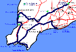
We start the tour in the middle of the island in Mozaga, a place that can be easily accessed form both of the big holiday resorts Puerto del Carmen or Costa Teguise. In Mozaga, we only visit briefly the farmer monument in order to drive then alongside the wine road in southern direction. In the south of the island, some natural highlights of volcanic nature, some places that are worth to visit and specially some dream beaches that at least should be seen once, wait for us. My tour ends in Puerto del Carmen in order to get recovered form the "exertions" of the tour in one of the large sand beaches. Monumento al Campesino in MozagaIn a traffic island at one of the most important traffic intersection points of Lanzarote, practically in the core of the island, one adjoins the sculpture heighted aproximately 15 m, that probably would be passed with disapproval and puzzled if one was not aware of the fact that at this point, the grand César Manrique set a monument for the assiduous farmers of the island in the year 1968 (Monumento al Campesino = farmer monument). 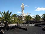
César Manrique created this sculpture of laquered scuttlebutts; Not only the tourists but also the farmers and the local people need an explanation of what the artist wanted to represent with the butts: the water tanks symbolize the big significance of the water and the sea for the inhabitants of the island. The whole monument symbolizes a farmer with a dog, a dromedary and a donkey. Modern art can be that simple... Right at the Monumento al Campesino there is also a little farmer museum that can be confidently discarted. Those who are hungry should better have a goody at the adjacent restaurant, where there is traditional Canarian cuisine offered. La GeriaBy driving from Mozaga to the south in direction to Uga, one passes the wine cultivation area La Geria. Although one finds grapevines and bodegas throughout the whole stretch, the real area La Geria does not start before the place Masdache. Between Masdache and Uga, one drives for more than 10 km through volcanic mountains, on which wine is cultivated in the manner of Lanzarote: complete hills and plains are supplied with little cavities, in which only one vine grows in each. The little cavities are partly individually walled, in order to protect the vines against the wind. It is not surprising that the wine of La Geria is not cheap. 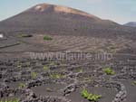
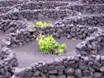
The wine cultivation valley itself transmits a deep quietness, here, the wine matures placidly along. But the quietness is disturbed umpteem times per day by travel buses woth tourists. Alongside the road, there are some bodegas where one can get some tasters and buy some wine; When there are already three or more tavel buses parked on the parking place, one should better hit the ground running, as such herds of gratis.bargain-hunter-tourists do not match at all to a relaxing holiday in Lanzarote. The wine of La Geria tastes excellent. It is something for real connoisseurs that like a real fruity and berry wine. The wine is mild and digestible, but unfortunately not really cheap, so that it stays to be rather something special to drink one or another bottle of wine of La Geria during my holiday; in the restaurants, the bottle's price starts from 12 €, in the bodegas from 5 €. The wine road of Lanzarote ends in a place named Uga, from which there are only a few kilometres to the adjacent place Yaiza where we do a little stop. YaizaYaiza is a wonderful little village in which the 2.000 inhabitants do everything in order to maintain their little place in apple-pie order, like it is. Lastly, Yaza was already crowned several times for being the most beautiful village in Spain. By driving to Yaiza, one already notices by the acceess roads what is coming. The streets that are bordered with palms and stones lead to the centre of the location where the church Nuestra Seņora de los Remedios is located. This little church appears to be simple and dark, but still beautiful. 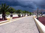
Of course, everybody has to see for oneself if the place deserved to be the most beautiful village of Spain. In Yaiza, there are palms, trees and plants everywhere without sprawling wildly at any place, but carefully cultivated. There is no fallen off palm leaf under a tree and no parched twigs are hanging down from the plants; Everything is well kept as in a huge garden. Also the houses shine and sparkle in the sunlight as they were recently built. In Yaiza, best is to have simply a walk through the alleyways for half an hour to look at the houses and plants. There are some restaurants that advertise with typical spanish food. There are enough parking places inside the little village. From Yaiza, there are two roads that lead to the southern tip of the island; but we do a little detour to the west coast of Lanzarote. El Golfo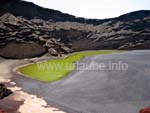
The place El Golfo is in fact only a little fisher village with a lot of holiday appartments that are vacant most of the time. But the place is famous for its green lagoon that is part of the obligatory program of every tourist in Lanzarote. The Lago Verde extends corrugated in a cliff bay. The emerald-green colour is of the precious stones olivin, that are also loose in the beach. The lagoon gets the water from below which means that when the sea level increases by a high tide, also the water level of the lagoon increases. There are two possibilities to visit the Lago Verde: from the north, a wide path leads straight to the lake and down to the beach and one can see the green water from a close range. But the view from the observation deck at the south of the lake is more impressive. From a parking place, one gets to this view point by a walk of approximately 5 minutes. From this point it is also recognizable that the rock face at the left is a relict of a giant volcanic crater which other side slipped into the sea long time ago. Accordingly, the Lago Verde is a crater lake. Los HerviderosAt the coastal road between El Golfo and the salt fields Salinas de Janubio there are the Hervideros; All of the island tourists meet at a big parking place. The travel buses partly carry 50 tourists at once to the famous rock cliffs. What is right visible at the sea coasts that attracts thousands of tourists? 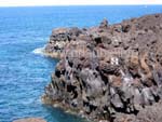
At this little coast section, in the course of thousands of years, the sea has beaten some caves and rifts into the lava rocks. Through tunnels, stairs and bridges it is possible to see the manipulations of the surge from all perspectives. The area of the Hervideros is not specially large, one practically walks on little paths in the rock in order to repeatedely enjoy new views. What is nearly more impressive than the caves and chinks beaten by the water in the course of the time is the noise made by the surge, when a large wave hits the end of a rock grotto. The paths between the rocks are very narrow and on the stairs, it is partly not possible to walk beside each other. If there are already some big travel buses on the parking place, the visit of the Hervideros will be a little unpleasant. Salinas de JanubioBy driving the road alongside the west coast further in southern direction, one gets to the salt fields of Janubio. By driving on the road from Playa Blanca in direction to Yaiza, the checkered fields of different colours already stand out from a far distance. What first seems to be a huge natural mosaic, is the relict of a centuries-old factory of salt production. Here, still today the salt is extracted from the sea water in a traditional way. The principle is very simple and straight understandable for the visitor: 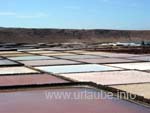
With the power of the winds, the water is supplied to the upper located basins. From there, it flows in a long canal very slowly into the upper salt water basin. Once a basin is filled with sea water, the water remains there for a while exposed to the sun. The water evaporates, the salt remains. After a time, the saline water is drained into a lower situated basin and the upper one is refilled. From basin to basin, the salinity increases until at the end there is only the white good without any water remaining. It is indeed possible to drive down the the salines of Janubio, but the access to the fields is forbidden. One gets the best view to the salt production fields from the observation deck by a restaurant at the northern end of the salt fields. El RubicónWe drive from the salt fields down to the very south to Playa Blanca. Thereby, we cross an area that was named after its red colour El Rubicón. The huge solitude with its penurious nature appears to be really scarry and threatening. The whole area is mainly inhabitated; there are only some loose houses in this plain. During the drive through El Rubicón it is hard to believe that at the southern end, one will arrive at a huge touristical centre named Playa Blanca. However, the drive through El Rubicón is interesting. At the left side (by driving in southern direction) the round formed foothills of the Ajache mountain are visible; thus, one sees the oldest part of Lanzarote. At the south west tip of the island the local mountain of Playa Blanca named Montaņa Roja (= red mountain)arises, that bit by bit is getting larger. Punta de Pechiguera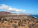
Before we drive into the centre of the tourist city Playa Blanca, we turn into the south west tip of the island, to the Punta de Pechiguera. A big lighthouse stands lonely on a bumpy area. Only driving to the Punta de Pechiguera fascinating. One passes some huge hotel and appartment complexes that simply do not end. There is rather no other sport in the island where it is so cleary visible how the coasts of Lanzarote are getting more and more built up and inhabitated. This is the reason why I wonder how long the light house of Pechiguera will still stand lonely in his spot of the island. At the Punta de Pechiguera the sea waves roar against the rocky cliffs. Here, it is always windy even if it seems to be windless in the island. At a clear weather there is a wonderful view to the cliff island Lobos and to the whole northern part of Fuerteventura. And of course the view to Playa Blanca at the front is also enjoyable. Playa BlancaOn the way back from Punta de Pechigueara into the centre of Playa Blanca one passes Playa Flamingo. As it is possible to park at approximately 100 m distance from the beach, a short side is worthwhile. The beach that is bordered by two moles can be viewed from a little view point so that bathing mood comes up. Playa Blanca itself is not that long extended as the other bathing resorts of the island. There is a centre that is located at the harbour. There are also enough parking places at the harbour that can be used for free in order to explore the little fisher village on foot. Playa Blanca has a long boardwalk that is exclusively for pedestrians. Here, loafing is a real pleasure. I recommend to walk the promenade form the habour up to Playa Dorada. It is hard to experience Playa Blanca in a nicer way. Punta de AguilaFrom the harbour of Playa Blanca one can walk alongside the coast up to Punta de Aguila. But as we still had several stops to do in our tour, we prefer to drive to this distinctive point in the middle of the southern tip of Lanzarote. 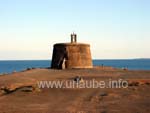
At the Punta de Aguila, there is the Castillo de las Coloradas, a little round fortification of the 18th century that once was built in order to protect the southern coast against the pirates. The little Castillo is rapidly viewed, but it needs much more time to enjoy the fantastic view from the little headland. The islands Lobos and Fuerteventura present themselves right in front of one. And then the view to the left side: here, the parrot beaches, nicely arranged to one another, glisten at the sun and literally call out to us: "come over to have a bath, here are the most beautiful beaches of the island!" And this is exactly what we do. Punta del PapagayoFrom the Punta del Aguila there are only a few kilometres to the parrot beaches, but these kilometres are very difficult, as the wide asphalt road becomes soon a bumpy gravel road that can't be abandoned. Those who live in Playa Blanca can also walk over to the parrot beaches or rent a bike. A further possibility is to get from the harbour of Playa Blanca by boat to the dream beaches. 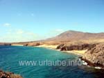
The beaches of Papagayo are all abulute dream beaches (see the side Beaches of Lanzarote). It is not enough to visit only one of these beaches as all of them have to be seen. There are several parking places from which it is possible to walk to the rock cliff. There are some gorgeos views down to the bright dream beaches; those who at that point can still resist having a bath must have a strong will of iron. But not only at the Punta del Papagayo only the beaches are interesting but also the views that one has from the beaches and/or rock cliffs. The islands Fuerteventura and Lobos are in front of one; behind one, the high ridges of the Ajache mountain glisten in the sun. And in western direction there is the silhouette of Playa Blanca visible. One perceives to be in a unique place of the nature. The whole area at the Punta del Papagayo is not protected for nothing. Femés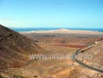
Our tour gets to the end; from the parrot beaches, we drive back to northern direction. But before we get again to Playa Blanca, we turn to the mountains in direction to Femés. Femés is one of the few little places of the Ajache mountains; actually, the place only consists on a little church, a little village square, a few houses and restaurants and a view terrace, and this is exactly the reason why Femés is visited by numerous tourists. The Balcón de Femés is the last place of the little place that is covered with buildings before it goes steeply to the Rubicón-plain. From there, there is a fantastic view to Playa Blanca and the huge Rubicón-plain in the south west of the island. The red mountain heighted 194 m (Montaņa Roja) forms, viewed from Femés, a distinctive point as a south-western limitation of the island. Puerto del CarmenFrom Femés we drive again into northern direction to Puerto del Carmen. We enjoy the drive from Femés through the oldest mountains of the island Los Ajaches to the full. The area is indeed very dry but the shape of the mountains and valleys is worth to see. In Puerto del Carmen we finalize the day tour with a placid relaxation on the beach and a following ramble alongside the beach road. What a day full of events is ending! 
Copyright: Patrick Wagner, www.tourist-guide.biz |
||